Canvas X GEO
Canvas X GEO
| Product | Rating | Most Used By | Product Summary | Starting Price |
|---|---|---|---|---|
 Canvas X GEO | N/A | Combining a rich graphic toolset with sophisticated geospatial data handling, Canvas X Geo is a geospatial data illustration software designed to work in tandem with Geographic Information Systems. Represent, filter, and integrate a wide range of geospatial data formats in a single, powerful application Import and work with documents containing over one million objects in high resolution Drive seamless data collaboration thanks to numerous outputs, including maps,… | $299 Per 1 year license |
| Canvas X GEO | |||||||||||
|---|---|---|---|---|---|---|---|---|---|---|---|
| Editions & Modules |
| ||||||||||
| Offerings |
| ||||||||||
| Entry-level Setup Fee | No setup fee | ||||||||||
| Additional Details | — | ||||||||||
| More Pricing Information | |||||||||||
| Canvas X GEO | |
|---|---|
| Small Businesses |  CorelDRAW Graphics Suite Score 9.7 out of 10 |
| Medium-sized Companies |  GIMP Score 9.3 out of 10 |
| Enterprises | CorelDRAW Graphics Suite Score 9.7 out of 10 |
| All Alternatives | View all alternatives |
| Canvas X GEO | |
|---|---|
| ScreenShots | Canvas X GEO Screenshots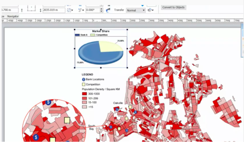    |